


Étang Balmette

crognon
User
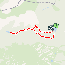

Length
6.4 km

Max alt
2071 m

Uphill gradient
296 m
Km-Effort
10.4 km

Min alt
1770 m

Downhill gradient
301 m
Boucle
Yes
Creation date :
2019-06-22 12:54:41.03
Updated on :
2019-06-22 19:26:18.545
3h25
Difficulty : Very easy

FREE GPS app for hiking
 SityTrail
IGN / Geographical institutes
SityTrail Plus
The world is yours!
About
Trail Walking of 6.4 km to be discovered at Occitania, Pyrénées-Orientales, Les Angles. This trail is proposed by crognon.
Positioning
Country:
France
Region :
Occitania
Department/Province :
Pyrénées-Orientales
Municipality :
Les Angles
Location:
Unknown
Start:(Dec)
Start:(UTM)
422195 ; 4715518 (31T) N.
Comments